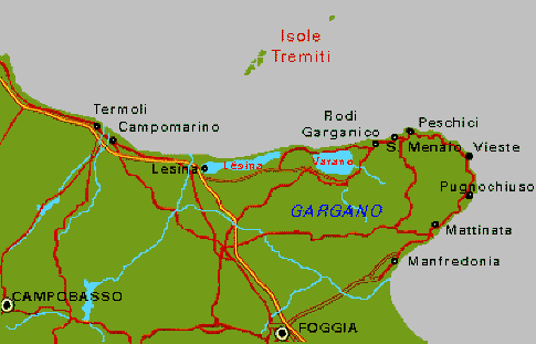
Lesina, Italy
Lesina, Italy sits at the western end of a lake of the same name. It is located just east of what is referred to as the "spur" of Italy. Lake Lesina is actually a shallow lagoon, oval shaped, which runs parallel to the Adriatic coastline. It is separated from the sea by a low strip of coastal vegetation called Bosco Isola. The lagoon is approximately 13.5 miles long, and between 1 and 2 miles wide. Its maximum depth reaches less than six feet.
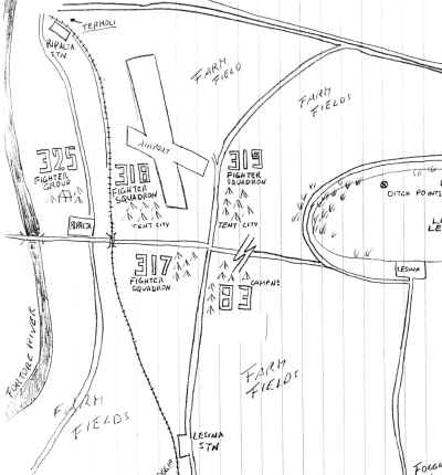
The 325th airfield was on the west side of the lagoon, slightly northwest, of the town. The main runway, of the airfield, ran almost perpendicular, to the lagoon, in a northwest/southeast direction. The main runway sloped, so that most take-offs went downhill, towards the water.
A railroad ran along the west side of the field, almost parallet to the runway. West of the railroad, a road ran parallel, and west of that, the Fortore River. A road, from Lesina, ran in a north-south direction, along the eastern side of the field. Another road, ran east to west, along the southern edge of the field.
The Headquarters area was located on the west side of the field, between the river and road. To the east, across the tracks, was the 318th squadron. The 317th Squadron was set up on the southern end, on the south side of the road. Finally, the 319th Squadron was on the eastern side, between the road and lagoon. (See sketch, drawn by 325th member, not to scale.)